VesselCube is a global database of offshore vessel supply and demand, with complete coverage of historical and future vessel demand from platforms, rigs, subsea facilities and offshore wind installations. Driven by bottom-up data on rig mooring, platform supply, cable-lay, xmas-trees, turbines, foundations, and offshore substations, split along several market dimensions.
Understand the drivers of the offshore vessel market
Get a complete overview of global trends
Find O&M opportunities by exploring the installed base of various categories of offshore infrastructure
Analyze upcoming projects that have yet to be sanctioned
Understand demand for key services and components on upcoming offshore projects.
Managers and strategists focusing on the supply chain for offshore vessel markets:
Engineering, procurement, and construction companies.
Equipment and service suppliers.
Project developers.
Consulting and advisory firms.
Banks, investors, and funds.
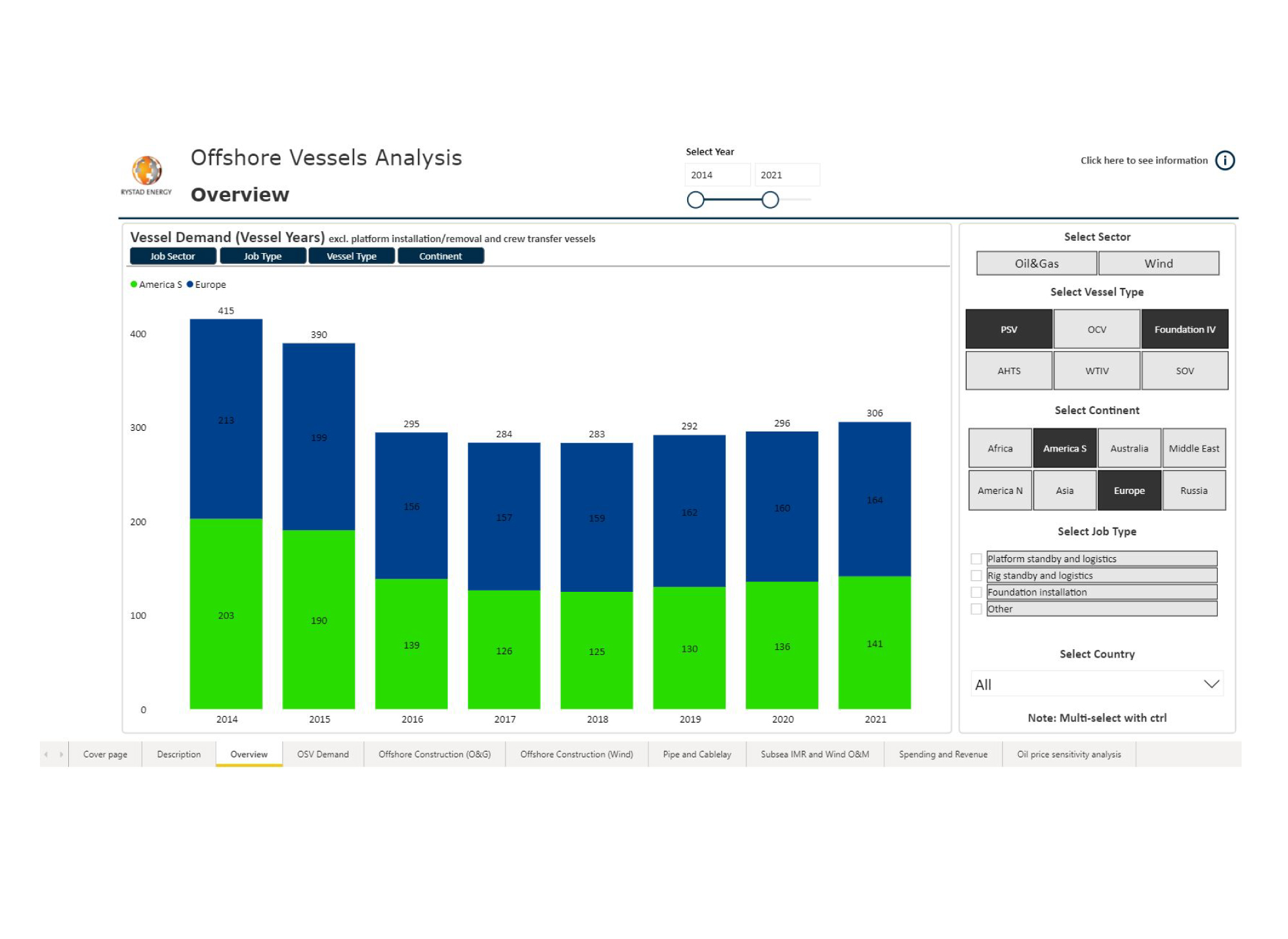
VesselCube can be used to analyze the global Vessel demand. Understand which regions will have the highest demand for Vessels over the coming years, and which job types or vessel types will represent the demand. Identify which operational environment and in which segments demand will grow going forward.
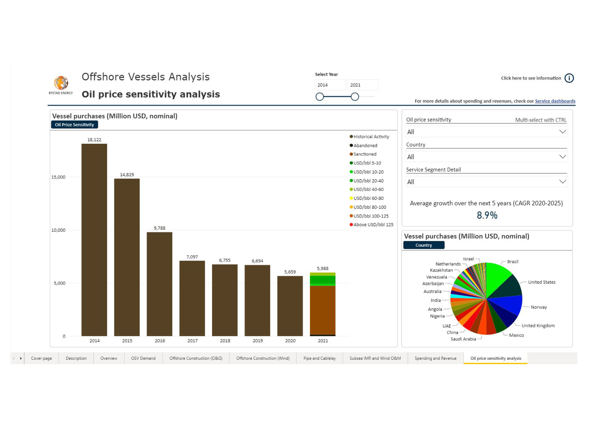
VesselCube can be used to understand how the vessel market is affected by various oil price scenarios. Dig down to examine vessel demand for specific projects in all corners of the globe, along with the associated breakeven price. Remove projects with high breakeven prices to see downside in a low oil price scenario.
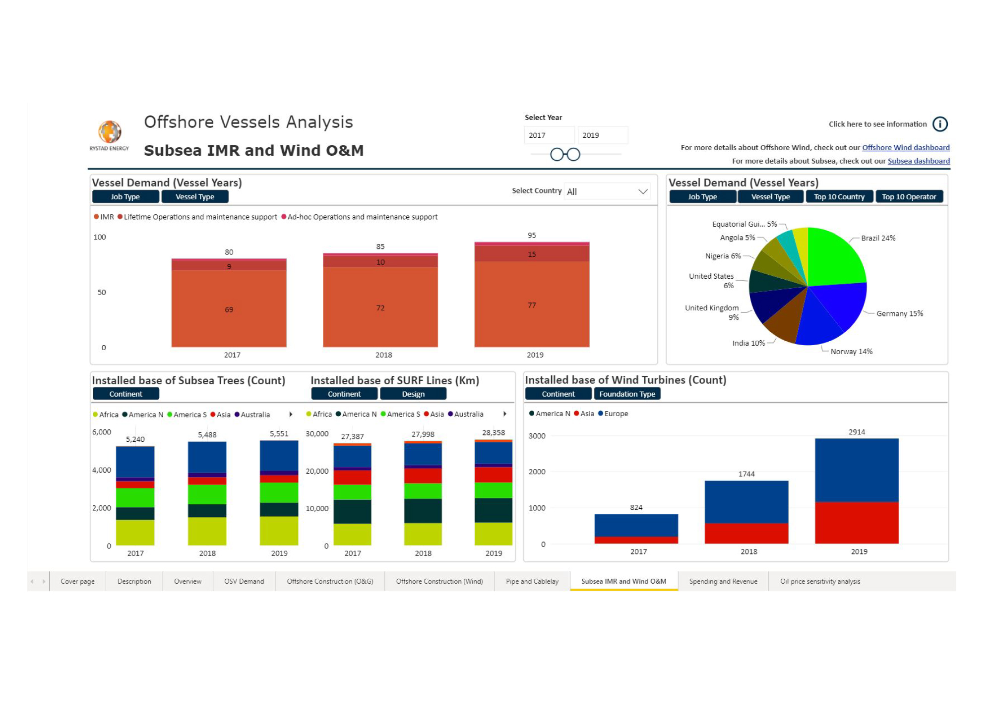
Find O&M opportunities by exploring the installed base of infrastructure within the various offshore segments.
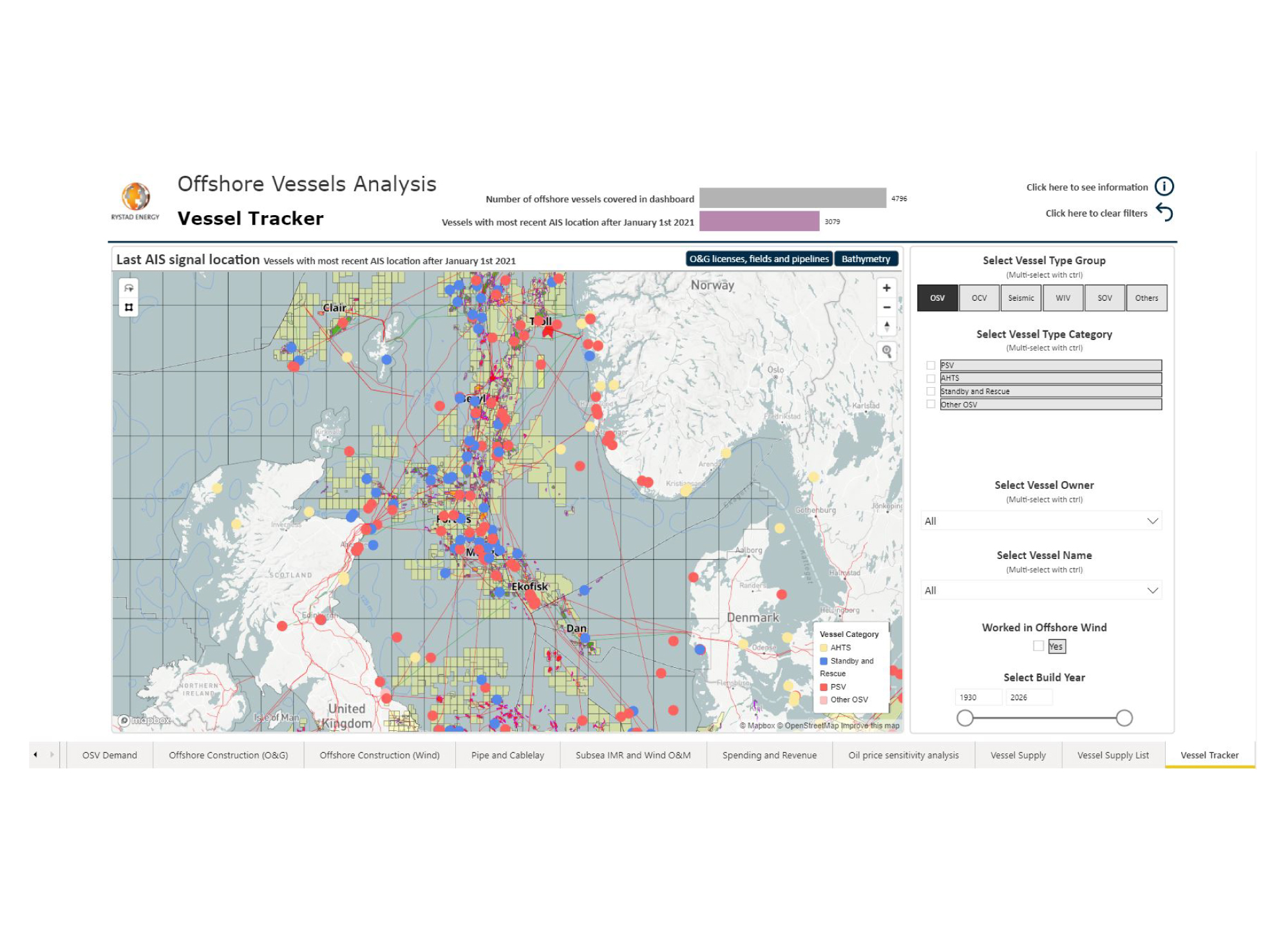
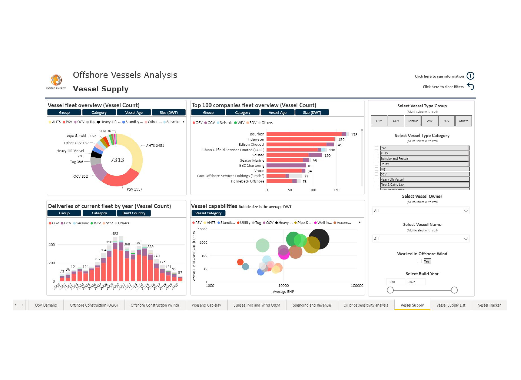
The Offshore Vessel dashboard can be used to analyze the composition and capabilities of the global offshore vessel fleet. Identify top vessel owners and the supply of different vessel groups and categories. The tool can also be used to study the key attributes and capabilities of single or multiple vessels.
The Vessel Tracker shows the latest position of all active vessels transmitting AIS signals. The map is layered with all O&G licenses, fields and pipelines, as well as bathymetry to illustrate water depth. Pinpoint the position of a single vessel or the entire fleet of a selected vessel owner, split into groups and categories.
